Other Solutions Military Meteorology and Atmospheric Intelligence
Hidromod
From data to foresight, from foresight to decision
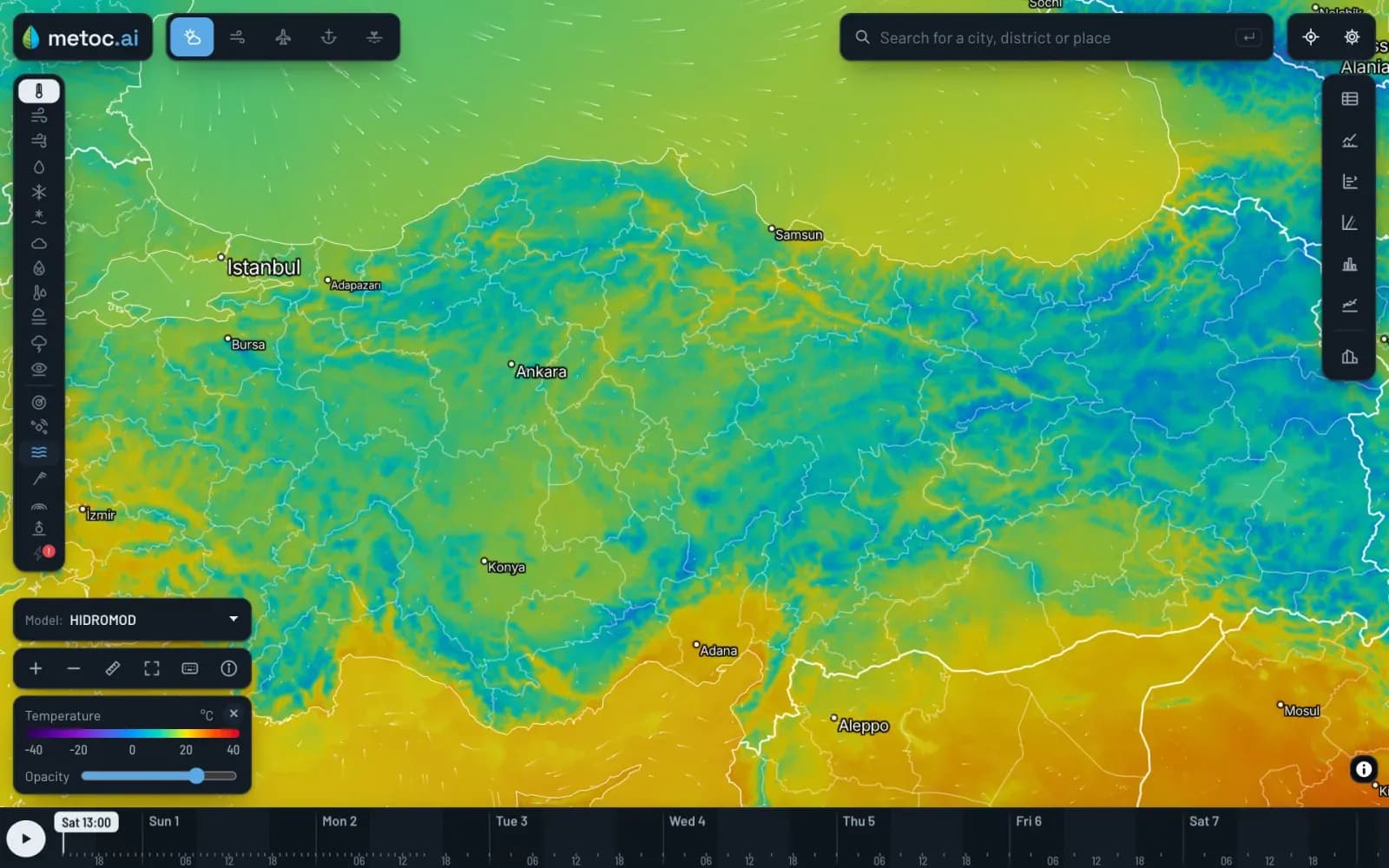
Hidromod is a Turkish military meteorology and decision-support solution, developed at ODTÜ Teknokent, that calculates the impact of atmospheric conditions on radar, sensor, effector and operations planning systems before a mission begins.
- Numerical Weather Prediction Model Developed in Türkiye
- ISO 9001 - ISO 27001
- Closed-Network Deployment
How It Works
From observation to decision: four steps
- 01
Observe
Satellite, radar, ground station and mobile tactical station data is collected and quality-controlled.
- 02
Model
A high-resolution model developed in Türkiye runs with data assimilation; altitude–time profiles and uncertainty bands are derived along the mission route.
- 03
Assess impact
The effect of expected conditions on the thresholds of each sensor and effector is calculated.
- 04
Deliver
Results are delivered to the system and the operator display via an external interface and API.
Every output can be traced back to its input source and model version
Problem
The problem is not a lack of weather data; it is that weather data is not linked to the system’s decisions
Both ends of the air defence chain depend on the atmosphere: rain attenuates radar, fog blocks EO/IR vision, wind deflects munitions and humidity absorbs laser energy. Atmospheric layers bend radar waves and cause false tracks.
Meteorological data is often available, but it remains a general weather report. Signal processing only sees the echo; telling where it comes from requires knowing the three-dimensional state of the atmosphere in advance.
This is not new; what is new is that laser weapons, seeker-guided missiles and unmanned platforms have made systems far more sensitive to the atmosphere. NATO has long formalised this field through STANAG 4061 and 6015.
Developer / Integrator
Tries to contain weather-related performance loss in signal processing; because the root cause is the atmosphere, the problem is never fully solved.
Operator / Operations Planner
Sees sensor and effector suitability only once conditions occur; the choice cannot be planned in advance.
Meteorology Unit
The forecast it produces remains a general report instead of being converted into system thresholds.
Organisation
Systems cannot use their full capability in the field; the value of the investment depends on the weather.
Know the weather, win the system
Solution
Weather data becomes an input tailored to each system’s threshold, not a general report
The solution is to forecast expected weather conditions by time and location, convert that forecast into its impact on each sensor and effector, and feed the result directly into the system. Every decision, from the radar algorithm to effector selection, is made before the weather develops.
About
What is Hidromod?
Hidromod is an atmospheric intelligence company founded in 2018 at ODTÜ Teknokent in Ankara, Türkiye. It combines more than 25 years of expertise in remote sensing, hydrology, meteorology and climate science with numerical modelling and artificial intelligence. Hidromod and MilSOFT operate under Forte Bilgi İletişim Teknolojileri ve Savunma Sanayi A.Ş.
Its military meteorology and oceanography (METOC) capabilities run on a single forecasting infrastructure: a numerical weather prediction model developed in Türkiye and operated over the country at 2.5 km resolution. Built on this infrastructure are HAVAİ for air platforms, KARAMOD for land operations, S-100-compatible DenizMod for maritime operations and UZAYMOD for space weather. The MilSOFT partnership ensures integration to defence software standards.
Hidromod is not a general-purpose weather service. It is a decision-support layer that translates atmospheric conditions into sensor, effector and mission thresholds.
Capabilities
Mission-Specific Atmospheric Modelling
Atmospheric conditions are modelled by mission type, area of operations and time frame; 0–6 hour nowcasts, 1–15 day numerical forecasts and 1–6 month seasonal forecasts come from the same infrastructure.
Goal: To base tactical and strategic planning on a single forecast source.
Radar False Track Analysis
A meteorological impact probability and a reliability score are generated for each track; radar performance is forecast 72 hours ahead.
Goal: To feed the radar’s signal processing chain with atmospheric data without changing it.
Sensor and Effector Suitability Windows
Suitability for radar, EO director, laser rangefinder, IIR and RF seeker missiles and laser weapon systems is calculated in advance for every time slot of the day.
Goal: To plan which sensor and effector to use at what time before the mission begins.
Flight Path and Beam Path Forecasting
Wind along the flight path of smart munitions is provided in altitude layers; refraction and absorption of the laser beam are forecast from humidity, turbulence and temperature gradients.
Goal: To know the weather along the entire path, not at a single point.
Risk Mapping and Early Warning
Quality-controlled data is converted into operational risk maps, threshold-based alerts and decision-ready early warning outputs.
Goal: To see the impact of adverse weather on the mission before it occurs.
Secure and Isolated Infrastructure
Data layers separated by classification level, access-controlled workflows and a closed-network deployment option are provided.
Goal: To keep sensitive operational data within national network boundaries.
The Difference
Why Hidromod?
The real question is not “is there a weather forecast” but “is the forecast linked to the system’s decision”. Common weaknesses are general reports never converted into system thresholds, models and data that depend on foreign sources, and outputs that cannot be audited.
It ensures data sovereignty
The model and infrastructure are produced and operated in Türkiye; model parameters do not depend on any foreign source.
Physics first, then AI
The learning layer is built on top of a physics-based numerical model.
It protects the existing system
It is added via an external interface and API; it does not replace the radar’s or weapon system’s own algorithms.
It is audit-ready
Every output carries the model version and data timestamp, with an audit log and the option to re-run.
It leaves the decision to people
It does not issue firing orders; it shows probability and uncertainty openly.
It knows military meteorology from the field
The team understands military meteorology requirements and operational decision processes first-hand.
Use Cases
Air Defence
Provides expected weather conditions as input to sensor and effector selection; suitable time windows are set before the mission begins.
Radar Systems
Delivers the probability of fog, rain and hail to the radar by time and location; weather-condition algorithms are activated in advance.
Air Platforms and UAV Missions
Wind, cloud, visibility and turbulence are assessed along the route; the optimal route, time and flight level are determined.
Land and Maritime Operations
Meteorological data is provided for artillery fire missions, and wind, wave and current forecasts for naval operations.
Technology and Standards
Architecture
- Forecast model
- WRF-based high-resolution numerical weather prediction developed in Türkiye, corrected with observations through data assimilation. 2.5 km resolution over Türkiye.
- Forecast horizons
- 0–6 hour nowcasting, 1–15 day numerical forecasting, 1–6 month seasonal forecasting
- Data sources
- Satellite, radar, ground observation stations; mobile tactical meteorological station support
- Integration
- External interface and API; the data package format is defined together during requirements analysis
- Deployment
- On-premises, cloud or closed-network (air-gapped) deployment
Standards and Interoperability
- STANAG 4061 (ballistic meteorological message)
- Supported — scope defined per project
- STANAG 6015 (meteorological message and threshold formats)
- Supported — scope defined per project
- METAR / TAF
- Available
- IHO S-100 (DenizMod)
- Available